


Today and looking forward…
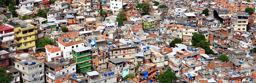 (Inside Rocinha Favela, 2010. Via Wikimedia Commons)
The population of Rocinha is uncertain. According to the Pereira Passos Institute, in 2010 Rocinha had a population of 69,156 inhabitants. However, some community agents estimate the favela’s population to be close to 100,000. The subregions of Rua Dois, Barcelos and Rua Quatro have the highest population density, containing approximately 30% of Rocinha’s residents. The favela’s inhabitants continue to struggle for structural improvements, including leisure spaces, light and water installations, waste treatment, transportation systems, public safety, and, principally, basic sanitation.
2013 // Where’s Amarildo?
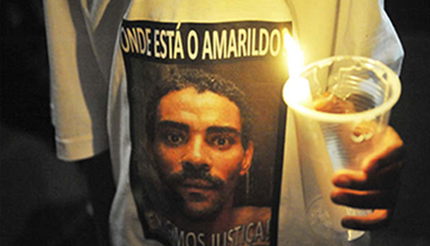 (Cadê Amarildo? Protesto na Rocinha,
Aug/2013 by Fernando Frazão, via Brasil de Fato)
(Cadê Amarildo? Protesto na Rocinha,
Aug/2013 by Fernando Frazão, via Brasil de Fato)
The resident Amarildo Dias de Souza, age 47, disappears after being detained by military police and taken to the UPP headquarters. The case becomes a symbol of abuse of power and police violence.
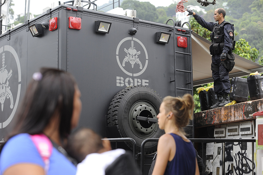
2012 // UPP and PAC
The UPP is installed with 700 military police officers, an administrative headquarters, eight bases and about 80 surveillance cameras. The Acceleration and Growth Program (PAC) also installs projects in the favela, among them the Passarela da Rocinha (a footbridge designed by Oscar Niemeyer), the Parque Ecológico (Ecological Park), and the Biblioteca Parque (Park Library).
2011 // Police occupation
 (Photo by Tânia Rego/ABr, via Wikimedia Commons)
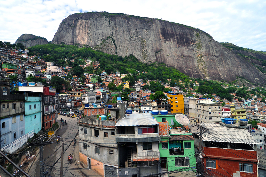
2010 // Largest in Brazil
The IBGE census names Rocinha the largest favela in Brazil. Its population is greater than that of 70% of Brazilian cities.
2008 // Right to memory
The group Pró-Museu, dedicated to preserving residents’ memories and stories of the region, consolidates various organizations into the Museu Sankofa Memória e História da Rocinha (the Sankofa Museum of the Memory and History of Rocinha).
2007 // Cultural heritage
The First Cultural Forum of Rocinha engages residents about sociocultural issues. The objective is to highlight and preserve the memories, stories, and cultural heritage of the favela’s residents.
2003 // Thinking about favelas
The book Thinking About the Favelas of Rio de Janeiro: 1906-2000, by Licia do Prado Valladares and Lidia Medeiros, is released. In the book, the authors find that Rocinha is Rio’s most-researched favela over the course of the 20th century.
2003 // Ecological interests
 (Rocinha Road, via Wikimedia Commons)
City Hall sets aside 82.21 hectares as an Area of Relevant Ecological Interest (ARIE). This area includes parts of São Conrado and Rocinha. The purpose of this action is to preserve local plant and animal life, restore the growth of native vegetation, and develop environmental education.
2000 // Growing commerce
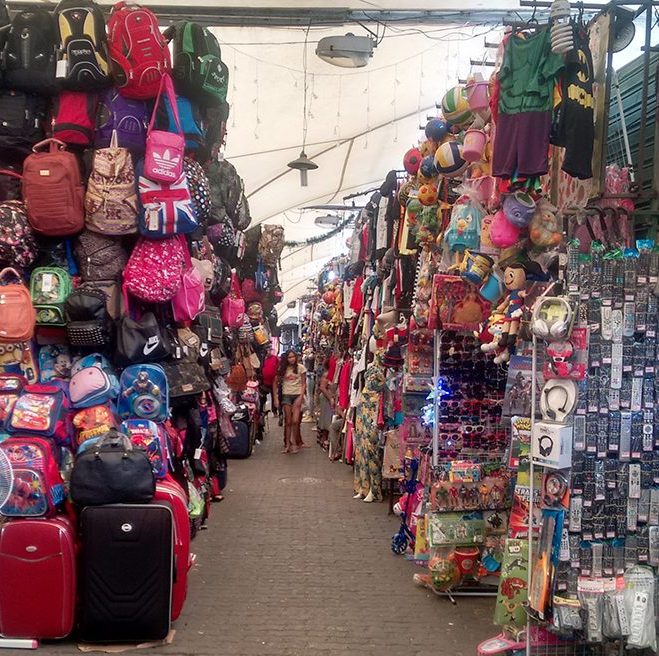 (Mercado Popular da Rocinha, photo by Vanessa Uliana)
Research by the Commercial and Industrial Association of the Neighborhood of Rocinha indicates the accelerated growth of local commerce, identifying more than 1,250 commercial points in the favela.
1990s // Traffic and gambling
Drug trafficking and gambling intensify as membership in residents’ associations falls.
1995 // Containing steep hillsides
The Geotechnical Institute of the City of Rio de Janeiro (GEO-Rio) builds containment structures on Morro Dois Irmãos (Two Brothers Mountain) after detecting fractures in the rock that threaten Rocinha with rockslides and soil slippage..
1993 // Rocinha becomes a bairro (neighborhood)
Rocinha is officially designated a bairro (neighborhood), but this new status does not bring with it projects to improve infrastructure or basic sanitation.
1992 // Safari in the favela
1991 // Deforestation
Under pressure from real estate speculation and high rents, residents come to occupy 25,000 square meters neighboring the Tijuca Forest. Because of their proximity to the forest, the occupants call their area Vila Verde (Green Village).
1989 // First bank
Rocinha receives its first bank branch, installed by the Bank of the State of Rio de Janeiro (Banerj). By 2016, there will be just three bank branches in the entire favela: Bradesco, Banco do Brasil, and Caixa Econômica.
1982 // CEDAE water spigots
CEDAE (the state water company) installs 15 public water spigots throughout Rocinha in response to community demands. Residents, however, consider this action insufficient, and double down in their campaigns for basic sanitation.
1980 // Literacy
Rocinha resident Francisca Elisa Medeiro Pirosi becomes an important figure in teaching literacy to children and teenagers who have failed out of traditional schools.
1977 // Women in power
A group of women assumes leadership of the Pro-Improvement Union of Rocinha Residents. Women come to lead important local movements, including collective organizations advocating for the cleanup of Rocinha’s open sewers and campaigns for the construction of a footbridge over the Lagoa-Barra highway. The footbridge will be completed in 1978.
1971 // Túnel Dois Irmãos (Two Brothers Tunnel)
1968 // Light
1966 // Landslides
Summer rainstorms ravage areas across the city. In Rocinha, landslides kill numerous people, destroy families’ homes and belongings, and cause displacements and removals. Environmental tragedy also occurs in 1967, 1996 and 2010.
1964 // Neighborhood of the displaced
1961 // Residents’ association
The Pro-Improvement Union of Rocinha Residents (UPMMR), the first residents’ association in the favela, is founded in the Largo do Boiadeiro subregion in lower Rocinha. The institution will halt its activities during the military dictatorship.
1947 and 1949 // Leão XIII (Leo XIII) and ASPA
The Fundação Leão XIII (Leo XIII Foundation), a Catholic group, installs itself in Rocinha and begins offering assistance and social services to residents. Another Catholic organization, ASPA, develops social, cultural, and religious programs, including a community daycare.
1944 // Expropriation
Anos 40 // Settlement and migration
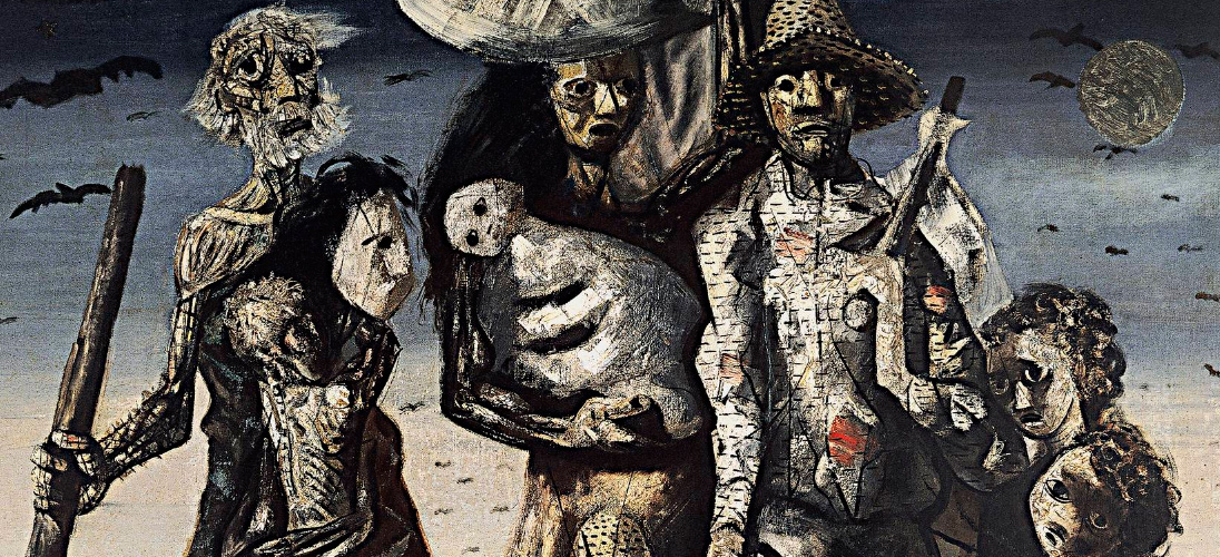 (Os Retirantes by Cândido Portinari, 1944. Via)
With improvements to the Estrada da Gávea (Gávea Highway) and beginning with the land allotments, many people begin to occupy plots of land in Rocinha, which they claim are “ownerless” or property of the government. Rio de Janeiro receives an enormous number of migrants from Brazil’s Southeast and Northeast, in addition to those from the interior of Rio de Janeiro state. Rocinha is highly sought after due to its location and the ample job opportunities in the surrounding area. Most of Rocinha’s dwellings are wooden huts, many of them built overnight.
1938 // Nossa Senhora da Boa Viagem (Our Lady of the Good Journey)
The Castro de Guidon family donates a plot of land in Rocinha to the Nossa Senhora de Paz Church in Ipanema. The friar Pedro Sinzig decides to build the chapel and school Nossa Senhora da Boa Viagem (Our Lady of the Good Journey), which comes to offer medical and psychological assistance to residents.
1933 // 1,447 huts
The first census documents 5,910 buildings in the constituency of Gávea. Of these, 1,447 are huts in Rocinha. The favela is still rural in appearance, with scattered homes made of wood or earth.
1930 // Change of command
1930 // The “baratinhas” (“little cockroaches”)
Paved and illuminated by streetlights, the Estrada da Gávea (Gávea Highway) comes to compose part of the Gávea Circuit, an automobile racecourse. The racecars are nicknamed “baratinhas,” or “little cockroaches.” The S-curve in Rocinha is considered one of the most dangerous curves in the world of automobile racing.
1920 a 1937 // Irregular land allotment
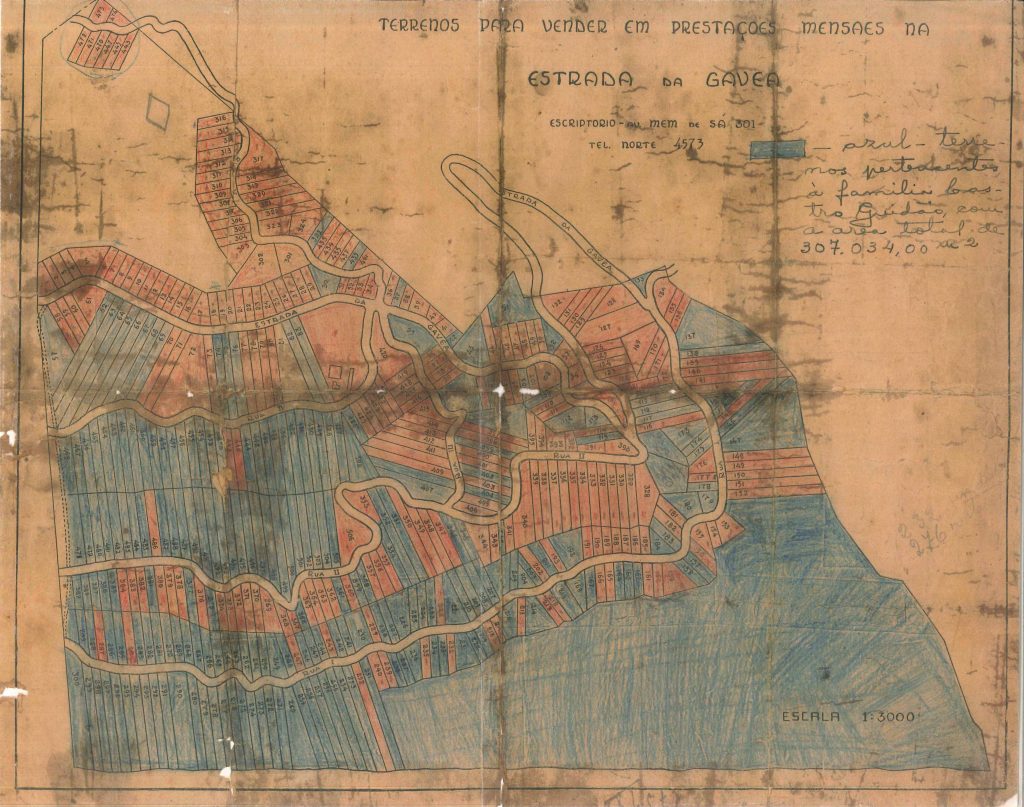 (Map via Museu Sankofa archive)
Neglecting to build the minimal infrastructure required by City Hall, the Castro de Guidon family sells plots of land to low-income buyers. The street names designated during the land allotment give origin to the modern-day regions of Rua Um, Rua Dois, Rua Três, and Rua Quatro (Street 1, Street 2, Street 3, and Street 4).
1916 // Avenida Niemeyer
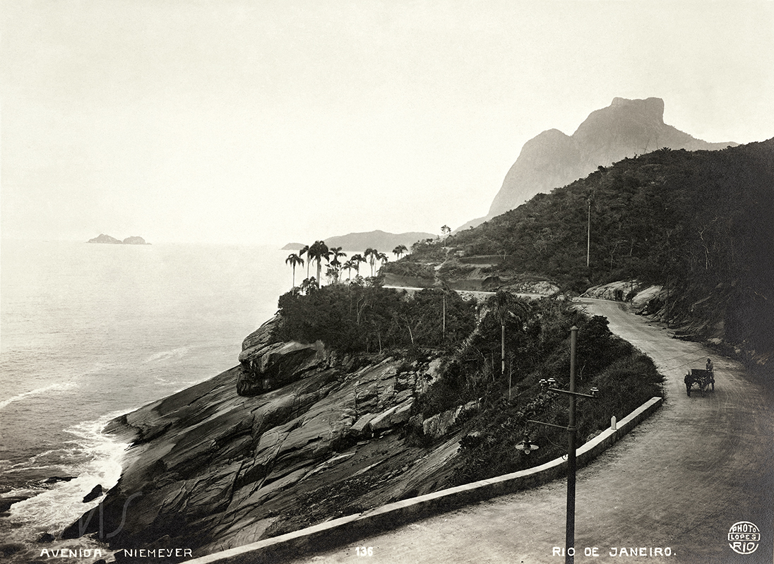 (Foto via acervo IMS)
Using his own funds, the engineer Conrado Jacob Niemeyer builds Avenida Niemeyer: a dirt road just over five kilometers long, without protecting walls, linking Leblon and São Conrado.
1910 // Fazenda Quebra-Cangalha (Quebra-Cangalha Farm)
The farmer Manoel Fernandes Cortinhas sells the Quebra-Cangalha Farm to Luiz Catanhede in order to settle a debt owed to the Castro de Guidão bank. The farm, which produces coffee, cattle, and sugarcane, extends all the way from Alto da Gávea to São Conrado, including all of what is now Rocinha. The farm is then acquired by the Castro de Guidon Real Estate Company, owned by a family of Portuguese origin.
1900 // Industrial Gávea
Beginning of the 20th century – Rocinha or Russinha?
The origins of the favela’s name are uncertain. Some say that peasants who worked on small farms in Alto da Gávea used to sell vegetables at the market in Gávea and tell people that their crops came from the “rocinha” (little farm). Others say that there was a beautiful blonde woman who lived in the region of the Quebra-Cangalha Farm and was known as “Russinha” (Little Russian).
1890 // Population growth
The abolition of slavery in 1888 and the expansion of transportation systems increase the flow of migrants arriving in Gávea and Alto da Gávea, where a vast settlement of huts begins to materialize.
Before 1888 // The quilombos
1870 to 1890 // Streetcar line extension
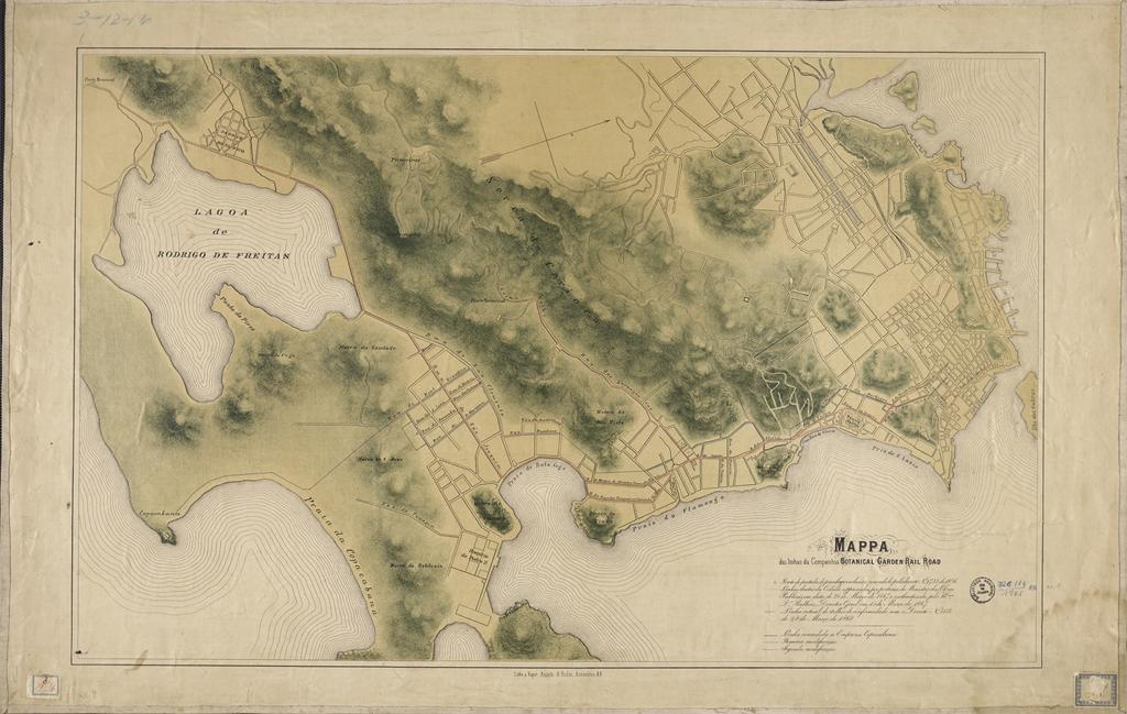 (Map of the tram lines of the Botanical Garden Rail Road Company, see more here)
The Jardim Botânico Company extends the streetcar line to Alto da Gávea (Peak of Gávea). The end of the line becomes known as “streetcar turn.” The installation of electric streetcars increases the flow of people in the region.
1850 – Land Law
 (Rio de Janeiro by
Alessandro Cicarelli Manzoni, 1844. Via Wikimedia Commons)
(Rio de Janeiro by
Alessandro Cicarelli Manzoni, 1844. Via Wikimedia Commons)
A legislative change establishes purchase as the only method of obtaining ownership of public lands, ending land tenure systems.
1565 // Founding of Rio de Janeiro
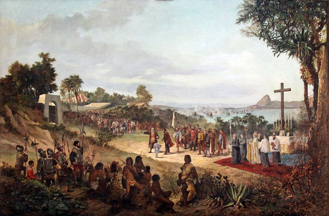 (Palácio Pedro Ernesto - Fundação da Cidade, 1565, via Wikimedia Commons)
After destroying a French colony in the region, Estácio de Sá founds the city of São Sebastião do Rio de Janeiro, between the mountains Cara de Cão (Dog Face) and Pão de Açúcar (Sugarloaf), in what is now the Urca neighborhood. The Portuguese establish themselves in the region by exterminating the native population.
Pre-16th century: The Tamoio Indians
The Tamoio Indians were a tribe of hunter-gatherer-fishers who lived on the northern coast of modern-day São Paulo state and the southern coast of modern-day Rio de Janeiro state. See more here (in portuguese).